Category Archives: Guatemala

Pink tide

Leaving Latin America, I want to comment on a phenomenon that seems to be sweeping this part of the world. It is the so called pink tide, the simultaneous occurrence of a left swing in the politics of the most countries on this continent. It is pink of course because bloody red is somehow appropriated by the communists, whereas the socialists can be safely painted in pink. Latin America has been under robust American control for many years, belonged to the immediate American sphere of interests. But especially in the most recent years, after the end of the Cold War, the situation here changed radically and one after another pieces of the domino fell as socialist or left-wing presidents won elections.

There are 12 independent countries in South America. Today there are left-wing governments in 9 of them, and Michelle Bachelet just won the first round in presidential election in Chile and is likely to win the second, making it 10 out of 12.

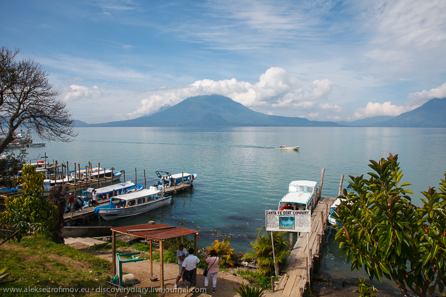
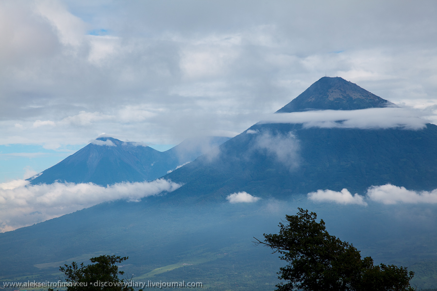
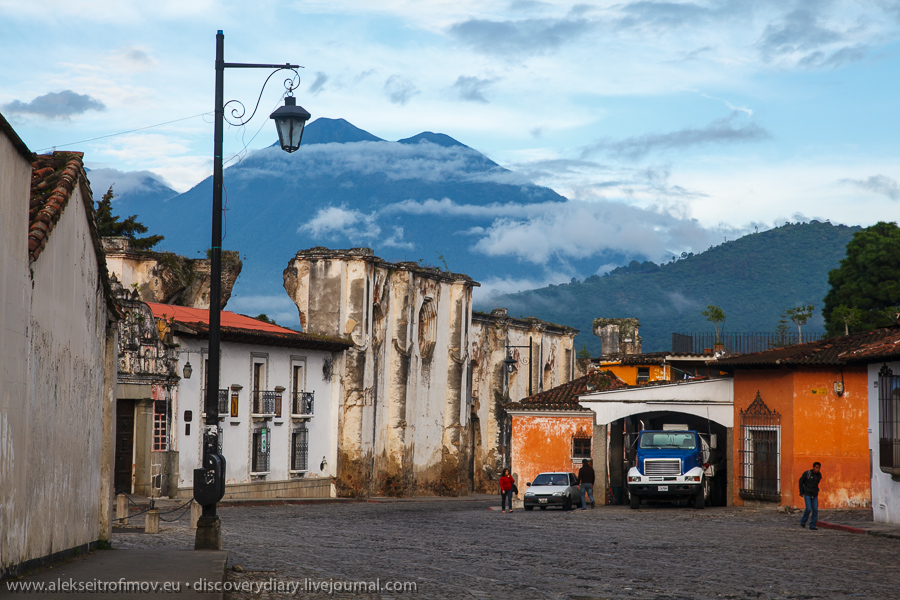
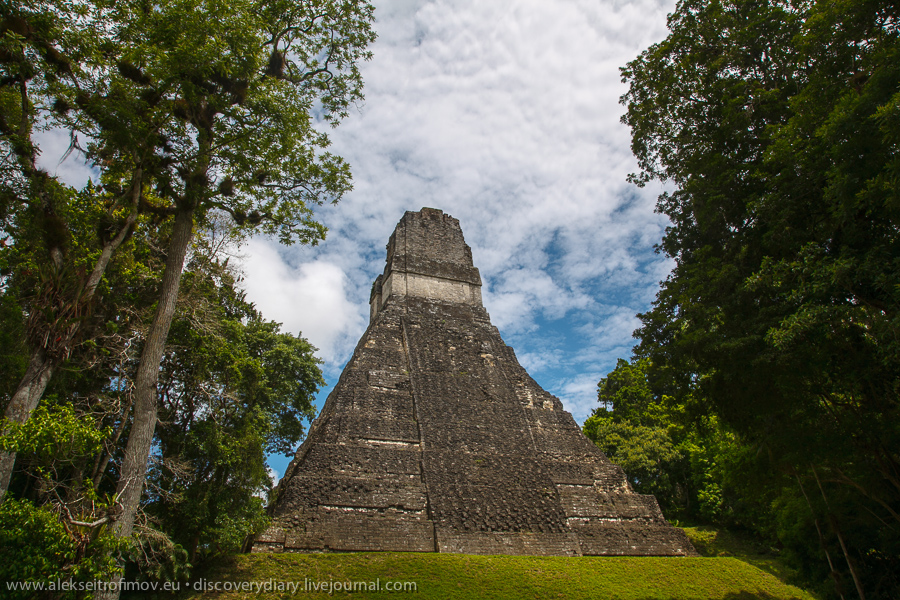
This is how it looks:


Continue reading Pink tide

Lake Atitlan

Lake Atitlan is truly a sight to behold. Three volcanos surround this very deep lake (480 metres), as well as 12 villages named by the Spanish after the twelve apostles. The villages are inhabited by the Maya, who of course speak their own languages. In every village there is a possibility to learn Spanish, living with a local family, and many people will remind you of this and offer you this as you walk along. Of course in truth Spanish is a second language for the locals, though I believe that might be a good thing for a beginner: after all they had to walk the same path of learning as you will. A minibus (another very early start, and it takes three hours from Antigua) took me to Panahachel, from where one can connect by boat to other villages on the lake.

First view of the lake, in Panahachel:

Continue reading Lake Atitlan

Pacaya

Guatemala boasts an impressive number of volcanos, however only three of them are active. The closest active volcano to Antigua is Pacaya. It takes about 1,5 hours on breathtaking mountain roads to reach it. I went with an organised tour as this is way easier than to book your own transport. Pacaya is 2552 metres high. An old American school bus left us off about midway to the top. Visitors can only go to about 2300 metres, as the volcano is actually giving out smoke and stones. At that altitude though everything is covered with lava.

The view of the neighbouring volcanos from Pacaya:

Continue reading Pacaya

La muy noble y muy leal ciudad de Santiago de los Caballeros de Goathemala

My next destination was Antigua. I took night bus from Flores and at 6 am we arrived in one of the many bus stations in Guatemala City. Estonian Foreign Ministry’s website comments that “no area in Guatemala City is safe”, so I felt a bit uneasy about looking for a shuttle to Antigua in a non-descript bus station. However I was not the only one in this situation, and demand gave rise to quick supply. At 7 am we were on our way, looking at the streets of Guatemala City, where men with serious guns guard one and two storey houses.

Antigua is the old colonial capital of Guatemala and one of the main tourist attractions. The grand old name of the capital was La muy noble y muy leal ciudad de Santiago de los Caballeros de Goathemala. In colonial times it was the capital of the Vice-Kingdom of Guatemala, which went all the way from South Mexico to Costa Rica, including 6 provinces which became independent states after the fall of the empire. The nobles of every province came here to elect the provincial government and to participate in social life. In 1773 a terrible earthquake struck, the city was destroyed, and the Spanish king decided to move the capital to another city, which became Guatemala City that we know today. The old capital came to be known Antigua, which literally means “old” in Spanish.

Antigua is located in the highland valley, surrounded by mountains and faced with three volcanos at its southern flank.

Continue reading La muy noble y muy leal ciudad de Santiago de los Caballeros de Goathemala

Tikal

Tikal is a majestic place. Chichen Itza and Uxmal impress by their style, elegance, sophistication of late Maya Renaissance. But Tikal is the peak of the Classic Maya civilisation, the imperial capital, majestic in its simplicity.

I got up at 3 am to come to Tikal early, when it is almost empty. I walked at times for half an hour without meeting a single person. During these meditative walks I was reflecting about what we see in Tikal today. As in most ancient cities, today’s Tikal is ersatz, mirage, it has a look that it never had before. In Maya times this was a huge city cleared of all jungle. Pyramids and other buildings were painted with bright colours. Many buildings that look restored to us would appear damaged to a Maya observer, as they lack important elements, arcs, roofs, passages. On the other hand, the way Tikal was first seen by European explorers also has nothing to do with its today’s image. Then it was completely swallowed by the jungle, almost without a trace of any building. Untrained eye would not have even recognised an ancient city, as the temples turn into low mounds and other edifices are swamped by the trees and the soil. In fact, new ancient Maya ruins are still found from time to time, because even from the air one cannot identify them in the middle of the jungle.

Tikal’s top temples:

Temple I
That’s the one we see on most of Tikal’s photos, Temple One, or the Temple of the Grand Jaguar. To me it looks like a phantasmagoric tunnel into the sky.

Continue reading Tikal