Tag Archives: Bolivia

Lagunas of Altiplano

The second and third day of the Salar de Uyuni tour take you to the South of the Salar itself. This is a rather meditative trip. The endless road and the enormity of the Altiplano landscapes accompany you. Several lagunas (shallow salt lakes) are the central attraction of this area. They are unusual because of their colour – pink and green – as well because of the flamingos that inhabit them. The colour of the lakes is given by particular microorganisms, and they are also the primary food of the flamingos. It is quite cold on the Altiplano year round, so this breaks the stereotypical view that imagines flamingos as tropical birds. They are doing very well indeed here, in the great remoteness not bothered by the humans.

San Juan village on the morning of the second day.

Continue reading Lagunas of Altiplano

Salar de Uyuni

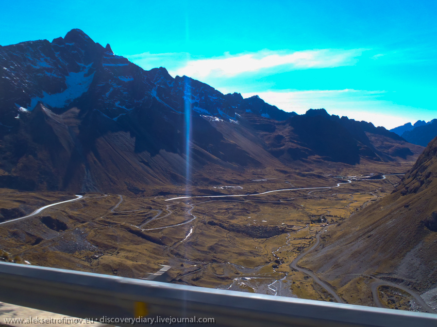
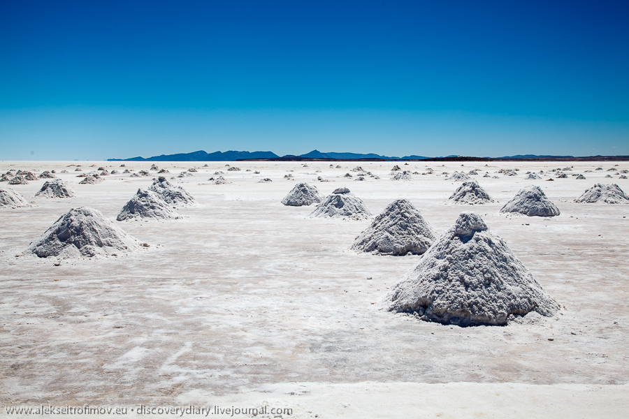
Salar de Uyuni is one of Bolivia’s greatest attractions. A strange formation, 10000 square metre large, is found in the South West of the country, in the corner formed by the borders of Chile and Argentina. The Salar is an ancient salty lake which dried up quite recently in geological terms – about 50000 years ago. The layer of salt several metres thick covers the ground in every direction you look, and the salt cover is so sizeable and so exceptionally flat that it is used by all the satellites to calibrate their measuring devices. The Salar is located on the Altiplano, altitude 3656 metres. The Altiplano itself is a rugged mix of mountains and valleys, on the contrary Salar is a perfect plane that can be easily crossed by car in any point.

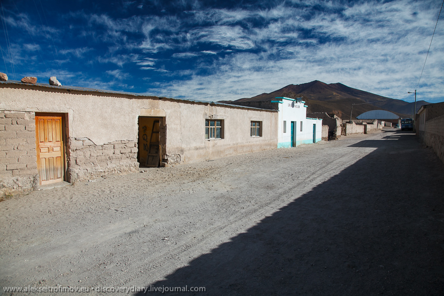
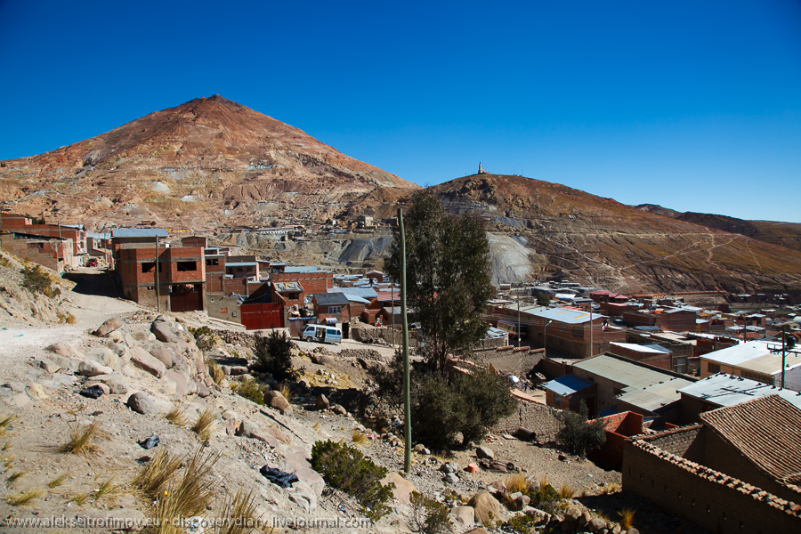
The Salar tours normally depart from the mountain outpost of Uyuni. You can venture from Uyuni to the Salar within one day, but the majority of tourists choose the three-day tours, and this is what I did as well. This tour spends the first day on the Salar itself and then continues further South towards the Chilean border. A Toyota Landcruiser 4×4 is usually shared between 5-6 tourists and a driver. I read lots of reviews and many of them warned about all kinds of risks caused mainly by the human factor – that the drivers tend to drink heavy alcohol when driving, speed unnecessarily, that the cars tend to break down and sometimes crash spectacularly etc. Already having experienced Bolivia’s safety standards, I knew that these stories were to be taken seriously. But even in Uyuni the choice of a tour company is very much a gamble – all 70 companies offer similar tours for similar prices, all have positive and negative reviews on the web, all say that safety would be ideal, and all may actually put you in a car of a different company. Travelling alone, I didn’t consider taking an individual tour, and in fact the idea of spending three days bonding with some unknown travel mates sounded kind of fascinating. Lonely Planet made a solemn promise that this bonding would be an unforgettable experience.

And all the promises came true. The Salar’s nature is absolutely spectacular. Our car broke down in regular intervals, its exhaust tube fell off entirely, and the driver spent half the trip under the track. At least he did not drink, which we carefully monitored. Finally the group I found myself in seemed tailor-made for me. We were six. All solo travellers. Five guys and a lady. 2 Brits, 1 Israeli living in Canada, 1 Venezuelan living in Barcelona, 1 Argentine and 1 Estonian Russian living in Brussels.

The tour travels considerable amount of time at the altitude above 4000. The nights are spent in pretty basic conditions: the first night in a salt hotel, the second at the altitude of 4200 in a army barack-type dorm of six. No heating in either place, and we were promised minus 20 degrees on the second night. In truth the sleeping bags saved from the cold. But overall, the altitude, the cold, the strange food, the endless road, the sun, all of this stresses the body and mind to no end.

But sharing this physical and mental challenge certainly helps you to get to know each other. During these three days we managed to discuss everything under the sun. The Israeli guy was particularly interested in the expressive opportunities of the Spanish language. The Spanish teacher among us obliged. And so for most of the trip our poor driver Zoher was glancing back in amazement why we are discussing various human activities in such graphic detail. I was more interested, as is my way, in people’s experiences, of life and of love, and so heard an account of passion and hatred in Cairo, an advanced course in crazy Argentinean politics, an insight into Israeli army’s recruitment and training and many other amazing stories. The whole trip was orchestrated like a theatre play. The key revelations on people’s identities only came in gradually, with appropriate suspense.

The first look at the Salar:

Continue reading Salar de Uyuni

In and out of Cerro Rico

Potosí is a place quite out of the ordinary. First, it’s the highest city in the world at 4090 metres. Second, this city was once the largest in all of the Americas, and even exceeded London and Paris at some point. The reason for all were the famous Potosí silver mines located inside Cerro Rico – the Rich Mountain. Enormous amounts of silver were mined there and served as the main source of income for the Spanish empire for several centuries. The silver was carried on the backs of mules to Lima and from there the imperial galleons took it over the Atlantic to Spain. The arrival or delay of these galleons were decisive for empire’s finances. The numerous wars led by the empire were financed by Potosí silver. The characteristically conical Cerro Rico looks over Potosí. They say that over the centuries of mining it has gradually lost several hundred metres in altitude.

Continue reading In and out of Cerro Rico

Sucre

My next stop was Sucre, the constitutional capital. Lonely Planet promises that Sucre will be Bolivia’s most pleasant city and the visitor will want to stay there much longer than initially foreseen. That prediction turned out perfectly accurate! Sucre is full of students, calmness and sun, and it was indeed very pleasant to spend a couple of days there.

The view of San Felipe de Neri convent. It is still used as a school. The visitors enter via the main school entrance and can see the still-functioning classrooms inside the historical building.


Continue reading Sucre

Tiwanaku

Tiwanaku is an ancient site located about 70 km from La Paz. It is considered the most important archeological monument in Bolivia. In the first millennium of our era Tiwanaku was the centre of a mighty empire, built not by conquest, but by religious conversion. Its original name is unknown, as there is no fully clarity neither to which language its inhabitants spoke nor where they went after Tiwanaku was abandoned following a catastrophic change in climate. Aymara, quechua and even uros all pretend to be Tiwanaku’s descendants and have quite elaborate theories to prove it. Whatever is the truth, Tiwanaku is a legendary centre for them all.

The most famous object in Tiwanaku – the Sun Gate:


Continue reading Tiwanaku

I am a Death Road survivor

The Death Road is a famous La Paz landmark, connecting the capital, located on the Altiplano, with Coroico, which marks the start of the jungle. The main part of the road, from the mountain pass above La Paz to the town of Coroico, descends from 4650 to 1200 metres in about 60 km. The Death Road was built by the Paraguayan war prisoners in 1930s. It is extremely narrow, about 3 metres wide on average, which means it essentially only has space for one motor vehicle – when two of them meet, they have trouble passing each other. The road has no side fences or railings and the cliff on the roadside is sometimes 600 metres deep. To force the downhill traffic to lower the speed, the road is driven on the left (as opposed to the rest of Bolivia), so that the downhill vehicle is always on the side of the abyss. When the road was actively used, about 200-300 people died there annually. So the roadsides today are filled with crosses marking the places of the accidents. About 20 years ago a new asphalted road was built, and nowadays the Death Road is no longer used by motor traffic. It is now predominantly the domain of bicyclists, those with a need for speed. As you realise, I joined that group.

Endless number of companies in La Paz offer the Death Road tour, which includes transportation until the highest point on the mountain pass, as well as back to La Paz from Coroico, a mountain bike, a guide to explain all the details, as well as a microbus which follows the group carrying the personal stuff and in case of accident.

The pictures in this post are not made by me, but rather by a Bolivian member of staff.

I had never before driven a mountain bike so it was a nice debut for me. To be honest I only felt scared in the beginning of the ride, when for around 12 kilometres you almost glide on the asphalted road over the abyss. During this downhill slide it was particularly clear that a slightest error would lead to potentially terrible consequences. This is how the first asphalted part looks:

Continue reading I am a Death Road survivor

La Paz

I like capitals. They have a special energy that makes me feel good. In La Paz too I felt this energy. The formal (“constitutional”) capital is Sucre, but La Paz is the real capital of Bolivia. At the end of 19th century the silver mines of Potosí got exhausted and so the centre of economic strength moved from the centre of Bolivia back to North East. As a consequence, the seat of the government was moved to La Paz. As of today, the situation changed again: the economy is now strongest in the East, Santa Cruz (where I write this) is the largest city. However as the political control is still associated with the Altiplano to the West, the East is unhappy and wants autonomy or even independence. Evo Morales in that sense is squarely on the Altiplano side and is quite unpopular in the East.

La Paz means “peace”, the full name of the city is Nuestra Señora de La Paz, i.e. Our Lady of Peace. This name was elected by the founding Spaniards to commemorate the victory over the Indians and the supposed peace that was thus found. In truth though peace was sorely lacking in the history of La Paz – an endless procession of juntas, putsches and executions characterises it.

The geography of La Paz is ridiculous, grotesque. Of all the world cities, I can only think of Rio as equally striking in its geography – but where Rio is almost kitsch in its beauty, La Paz is gothic. It occupies a long valley sloping downwards, and so the difference of altitude between its different barrios ranges from 3900 to 3100. The poor live where it’s more tough to breathe, whereas the rich areas are further down.

Continue reading La Paz

Isla del Sol

Lake Titicaca is divided roughly in half between Peru and Bolivia. Although the fishermen of both countries cross the border without hesitation many times a day, there is no regular connection on water between the two shores. Therefore I arrived in Bolivia by bus, and my first Bolivian town was Copacabana, which gave its name to a famous beach in Rio. To be honest Copa did not impress me much – it seemed rather like a pile of rubbish inhabited by lots of ants-locals. My days there coincided with a local religious festival, which meant that Copa was full of Bolivian visitors, music, noise, homemade fireworks and food scraps all over the ground. But my goal there was different. Early next morning a boat took me to the North of Isla del Sol – the Island of the Sun.

Tripadvisor and the rest of internet suggested that Isla del Sol is way more touristic than the Peruvian Titicaca islands. I reached a completely opposite conclusion. Isla del Sol rises above Lake Titicaca, silent and calm, and offers commanding views in every direction. The trek along the mountain ridge takes a few hours and lets you observe all the beauty in zen-like peace. Walking this path, I was full of wonder for the amazing landscapes put in front of me and for the journey that took me to this wonderful corner of the globe.

Continue reading Isla del Sol